Approximate Location Map
Large Map »
Latitude: 56.8437 / 56°50'37"N
Longitude: -2.6723 / 2°40'20"W
OS Eastings: 359083
OS Northings: 772674
OS Grid: NO590726
Mapcode National: GBR WW.QTWT
Mapcode Global: WH7PQ.X7MW
Plus Code: 9C8VR8VH+F3
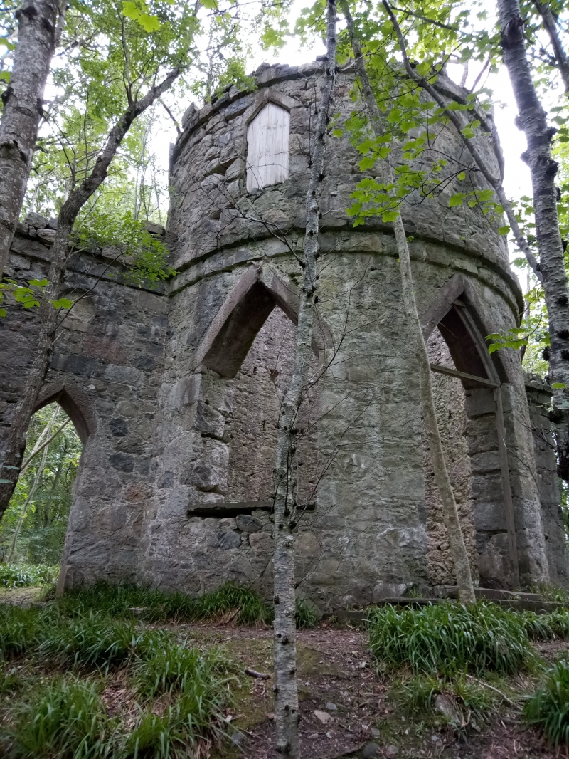
Entry Name: Doulie Tower, Edzell
Listing Name: Doulie Tower
Listing Date: 11 June 1971
Category: B
Source: Historic Scotland
Source ID: 343845
Historic Scotland Designation Reference: LB11265
Building Class: Cultural
ID on this website: 200343845
Location: Edzell
County: Angus
Electoral Ward: Mearns
Parish: Edzell
Traditional County: Angus
Tagged with: Tower house
Folly: Large circular tower 2-storey with curveless gothic
arches, flanked by wing screens with gothic arches. 1796.
Ruinous.
External links are from the relevant listing authority and, where applicable, Wikidata. Wikidata IDs may be related buildings as well as this specific building. If you want to add or update a link, you will need to do so by editing the Wikidata entry.


Other nearby listed buildings
