Approximate Location Map
Large Map »
Latitude: 56.3749 / 56°22'29"N
Longitude: -5.4719 / 5°28'18"W
OS Eastings: 185711
OS Northings: 725697
OS Grid: NM857256
Mapcode National: GBR DCWV.SG5
Mapcode Global: WH0GR.X1J8
Plus Code: 9C8P9GFH+W7
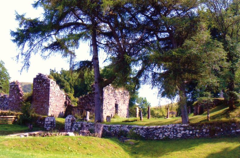
Entry Name: Macdougall Burial Enclosure, Old Kilbride Kirk And Kirkyard
Listing Name: Macdougall Burial Enclosure, Kilbride Burial Ground
Listing Date: 20 July 1971
Category: B
Source: Historic Scotland
Source ID: 344633
Historic Scotland Designation Reference: LB11981
Building Class: Cultural
ID on this website: 200344633
Location: Kilmore and Kilbride
County: Argyll and Bute
Electoral Ward: Oban North and Lorn
Parish: Kilmore And Kilbride
Traditional County: Argyllshire
Tagged with: Architectural structure
18th cent, Oblong. Rubble. No roof. Segmental arched
entrance (date '1786' in keystone; arms over) Interior:
Mural tablets. Gravestones. Grass-grown floor.
First MacDougall buried here was Iain Ciar, 22nd of
Dunollie, Chief of Clan in 1737.
External links are from the relevant listing authority and, where applicable, Wikidata. Wikidata IDs may be related buildings as well as this specific building. If you want to add or update a link, you will need to do so by editing the Wikidata entry.


Other nearby listed buildings
