Approximate Location Map
Large Map »
Latitude: 56.5835 / 56°35'0"N
Longitude: -5.3985 / 5°23'54"W
OS Eastings: 191385
OS Northings: 748676
OS Grid: NM913486
Mapcode National: GBR FC19.XN9
Mapcode Global: WH1GS.1SKD
Plus Code: 9C8PHJM2+9H
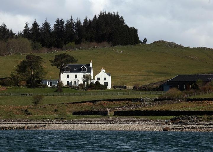
Entry Name: Shuna Farm House, Shuna Island
Listing Name: Shuna Farmhouse
Listing Date: 20 July 1971
Category: B
Source: Historic Scotland
Source ID: 345083
Historic Scotland Designation Reference: LB12343
Building Class: Cultural
ID on this website: 200345083
Location: Lismore and Appin
County: Argyll and Bute
Electoral Ward: Oban North and Lorn
Parish: Lismore And Appin
Traditional County: Argyllshire
Tagged with: Farmhouse
18th cent. Trad. 2 storeys and garret. 3 bays. Harled.
Gabled. slated roof. Gabled porch. 1 1/2 storey outlying
wing.
External links are from the relevant listing authority and, where applicable, Wikidata. Wikidata IDs may be related buildings as well as this specific building. If you want to add or update a link, you will need to do so by editing the Wikidata entry.


Other nearby listed buildings
