Approximate Location Map
Large Map »
Latitude: 56.6551 / 56°39'18"N
Longitude: -2.5096 / 2°30'34"W
OS Eastings: 368854
OS Northings: 751591
OS Grid: NO688515
Mapcode National: GBR VX.9P5G
Mapcode Global: WH8RQ.FZ5J
Plus Code: 9C8VMF4R+25
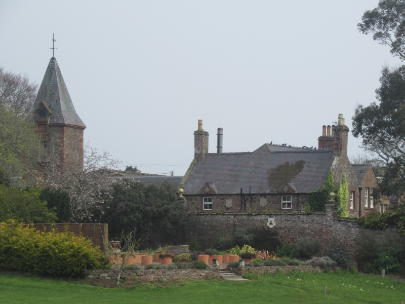
Entry Name: Home Farm, Lunan
Listing Name: Lunan House, Steadings and "Aunt's Cottage"
Listing Date: 11 June 1971
Category: B
Source: Historic Scotland
Source ID: 345243
Historic Scotland Designation Reference: LB12443
Building Class: Cultural
ID on this website: 200345243
Location: Lunan
County: Angus
Electoral Ward: Arbroath East and Lunan
Parish: Lunan
Traditional County: Angus
Tagged with: Farmstead
Small two-storey, rubble and slate. 18th cent., much
altered and extended c.1850.
Inset pediments in steading dated 1664.
External links are from the relevant listing authority and, where applicable, Wikidata. Wikidata IDs may be related buildings as well as this specific building. If you want to add or update a link, you will need to do so by editing the Wikidata entry.


Other nearby listed buildings
