Approximate Location Map
Large Map »
Latitude: 56.6796 / 56°40'46"N
Longitude: -5.1325 / 5°7'56"W
OS Eastings: 208208
OS Northings: 758591
OS Grid: NN082585
Mapcode National: GBR FCP2.5TP
Mapcode Global: WH1GJ.4C7P
Plus Code: 9C8PMVH9+R2
Entry Name: Seven Slate Workers' Boat Sheds, Loch Leven, Rudha Na Glas-Lice, Ballachulish
Listing Name: Ballachulish Rudha Na Glas-Lice Loch Leven Slate Workers' Boat Houses
Listing Date: 1 October 1992
Category: B
Source: Historic Scotland
Source ID: 346431
Historic Scotland Designation Reference: LB13307
Building Class: Cultural
ID on this website: 200346431
Location: Lismore and Appin
County: Highland
Electoral Ward: Fort William and Ardnamurchan
Parish: Lismore And Appin
Traditional County: Argyllshire
Tagged with: Architectural structure
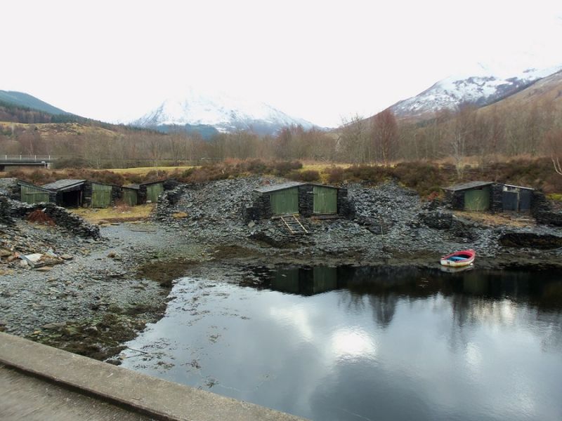
Predating OS 2nd edition map (surveyed 1870). Group of boat houses (now also used as tool sheds), comprising single, double and triple units, accommodating 11 boats in total. Constructed organically out of blue-grey Ballachulish slate shingle, emerging from man-made harbour banks, themselves created out of quarry refuse. Roughly squared slates laid according to dry-stone technique in horizontal courses forming thick side walls; simple boarded 2-leaf timber doors and over-door panels; mono-pitched roofs of large squared slate slabs laid flat in horizontal and vertical 'crossed' courses: one roof (easternmost boat house) re-slated to a different pattern, in even horizontal courses. One single boat house roofless (1992).
Listed for interest of use of materials and for historic significance of the Ballachulish slate quarries, which began operations from circa 1760. The 1870 map shows 8 boat houses on this site; further boar houses shown to the E of Rudha na - glas lice (='point/headland of the grey flat rock/stone'), and to W (at Cnap an Tairbh, listed separately); it also shows the transport system from the quarries to the S (now cut off from the Lochside by the A82), a tramway running around the circumference of the quarries leading to and from the Lochside to the E of this site. Groome describes this system: iron waggons were, "conveyed on 'lines' along the banks formed by the refuse, and laid down at little sheds, where they are, by one man, split up to the required thickness, and by another, cut into shape, after which they are ready for export.. there are five different descriptions of slate made, viz, queens, duchesses, countesses, sizables, and undersized." (1895, Groome p.112).
External links are from the relevant listing authority and, where applicable, Wikidata. Wikidata IDs may be related buildings as well as this specific building. If you want to add or update a link, you will need to do so by editing the Wikidata entry.


Other nearby listed buildings
