Approximate Location Map
Large Map »
Latitude: 56.2985 / 56°17'54"N
Longitude: -2.6597 / 2°39'34"W
OS Eastings: 359273
OS Northings: 711980
OS Grid: NO592119
Mapcode National: GBR 2X.72DW
Mapcode Global: WH8TD.3YRC
Plus Code: 9C8V78XR+94
Entry Name: Kingsbarns School, Main Street, Kingsbarns
Listing Name: Kingsbarns School Main Street
Listing Date: 23 November 1971
Category: B
Source: Historic Scotland
Source ID: 346888
Historic Scotland Designation Reference: LB13693
Building Class: Cultural
ID on this website: 200346888
Location: Kingsbarns
County: Fife
Electoral Ward: East Neuk and Landward
Parish: Kingsbarns
Traditional County: Fife
Tagged with: School building
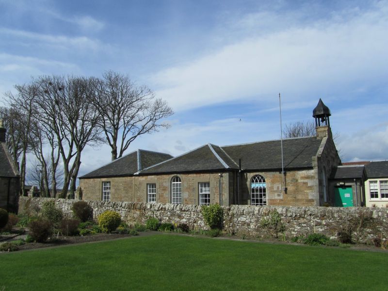
Dated 1822. Single-storey T-plan, ashlar gable front with pedimented porch and ogee-capped belfry with cast-iron columns; flanks droved rubble, slated roof, rear section piended with parallel W addition by James Gillespie of Kingsbarns, 1849. Round-arched windows with original glazing.
External links are from the relevant listing authority and, where applicable, Wikidata. Wikidata IDs may be related buildings as well as this specific building. If you want to add or update a link, you will need to do so by editing the Wikidata entry.


Other nearby listed buildings
