Approximate Location Map
Large Map »
Latitude: 56.5853 / 56°35'7"N
Longitude: -3.9982 / 3°59'53"W
OS Eastings: 277369
OS Northings: 745495
OS Grid: NN773454
Mapcode National: GBR JCH9.WSM
Mapcode Global: WH4LV.KR90
Plus Code: 9C8RH2P2+4P
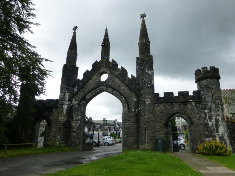
Entry Name: Kenmore Gate, Taymouth Castle
Listing Name: Kenmore Gate to Taymouth Castle, E. Side of Square, with Flanking Walls on Either Side.
Listing Date: 5 October 1971
Category: B
Source: Historic Scotland
Source ID: 347016
Historic Scotland Designation Reference: LB13807
Building Class: Cultural
ID on this website: 200347016
Location: Kenmore
County: Perth and Kinross
Electoral Ward: Highland
Parish: Kenmore
Traditional County: Perthshire
Tagged with: Architectural structure
3-arch gateway, rubble built. Large 4-centred main archway with crenellated gable over, flanked by octagonal towerlets and smaller side arches.
External links are from the relevant listing authority and, where applicable, Wikidata. Wikidata IDs may be related buildings as well as this specific building. If you want to add or update a link, you will need to do so by editing the Wikidata entry.


Other nearby listed buildings
