Approximate Location Map
Large Map »
Latitude: 57.2419 / 57°14'30"N
Longitude: -5.9043 / 5°54'15"W
OS Eastings: 164532
OS Northings: 823550
OS Grid: NG645235
Mapcode National: GBR C9TL.0BH
Mapcode Global: WGZ95.87PN
Plus Code: 9C9P63RW+P7
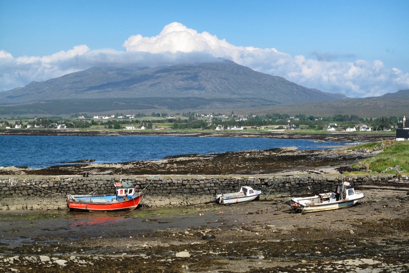
Entry Name: Old Pier, Broadford, Skye
Listing Name: Broadford Pier (By Limekiln)
Listing Date: 8 September 1982
Category: C
Source: Historic Scotland
Source ID: 347242
Historic Scotland Designation Reference: LB13991
Building Class: Cultural
ID on this website: 200347242
Location: Strath
County: Highland
Electoral Ward: Eilean á Chèo
Parish: Strath
Traditional County: Inverness-shire
Tagged with: Pier
Early 19th century, L-plan rubble pier, of dry stone
construction.
External links are from the relevant listing authority and, where applicable, Wikidata. Wikidata IDs may be related buildings as well as this specific building. If you want to add or update a link, you will need to do so by editing the Wikidata entry.


Other nearby listed buildings
