Approximate Location Map
Large Map »
Latitude: 55.7252 / 55°43'30"N
Longitude: -4.8803 / 4°52'49"W
OS Eastings: 219207
OS Northings: 651739
OS Grid: NS192517
Mapcode National: GBR 30.D7LB
Mapcode Global: WH2NF.0C99
Plus Code: 9C7QP4G9+3V
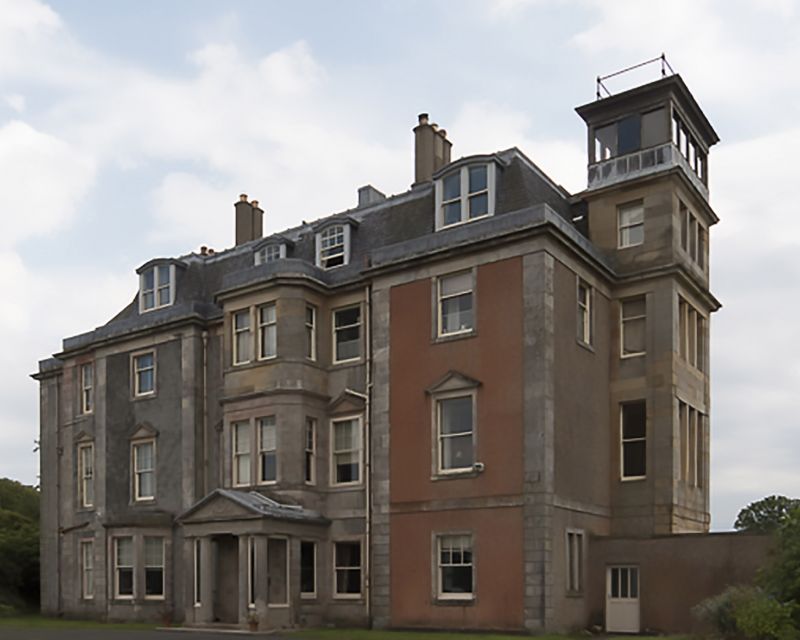
Entry Name: Hunterston House
Listing Name: Hunterston House
Listing Date: 14 April 1971
Category: B
Source: Historic Scotland
Source ID: 347588
Historic Scotland Designation Reference: LB14286
Building Class: Cultural
ID on this website: 200347588
Location: West Kilbride
County: North Ayrshire
Electoral Ward: Dalry and West Kilbride
Parish: West Kilbride
Traditional County: Ayrshire
Tagged with: House
1799. Georgian mansion, somewhat recast and extended towards
end of 19th century and later. Pink harling, white stone
dressings, 3 storeys, high pitched slate roof containing
modern dormers. Principal facade to north has pedimented
porch with fluted Doric columns; bay treatment of windows
on either side.
External links are from the relevant listing authority and, where applicable, Wikidata. Wikidata IDs may be related buildings as well as this specific building. If you want to add or update a link, you will need to do so by editing the Wikidata entry.


Other nearby listed buildings
