Approximate Location Map
Large Map »
Latitude: 55.9262 / 55°55'34"N
Longitude: -4.4608 / 4°27'38"W
OS Eastings: 246345
OS Northings: 673081
OS Grid: NS463730
Mapcode National: GBR 0Q.ZRVQ
Mapcode Global: WH3NS.G91R
Plus Code: 9C7QWGGQ+FM
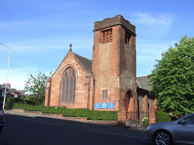
Entry Name: Old Kilpatrick Parish Church, Dumbarton Road, Old Kilpatrick
Listing Name: Parish Church and Graveyard
Listing Date: 14 May 1971
Category: B
Source: Historic Scotland
Source ID: 347737
Historic Scotland Designation Reference: LB14404
Building Class: Cultural
ID on this website: 200347737
Location: Old Kilpatrick
County: West Dunbartonshire
Electoral Ward: Clydebank Waterfront
Parish: Old Kilpatrick
Traditional County: Dunbartonshire
Tagged with: Church building
1812; addition 1897. Hall has 3 tall Gothic windows; western clock tower has pointed finials. Interesting old walled graveyard.
External links are from the relevant listing authority and, where applicable, Wikidata. Wikidata IDs may be related buildings as well as this specific building. If you want to add or update a link, you will need to do so by editing the Wikidata entry.


Other nearby listed buildings
