Approximate Location Map
Large Map »
Latitude: 55.9301 / 55°55'48"N
Longitude: -4.4804 / 4°28'49"W
OS Eastings: 245137
OS Northings: 673556
OS Grid: NS451735
Mapcode National: GBR 0Q.ZFF8
Mapcode Global: WH3NS.46RS
Plus Code: 9C7QWGJ9+2V
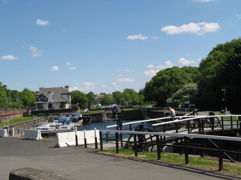
Entry Name: Drawbridge, Bowling Basin, Forth And Clyde Canal
Listing Name: 2 Canal Drawbridges at Bowling
Listing Date: 13 August 1973
Category: B
Source: Historic Scotland
Source ID: 347744
Historic Scotland Designation Reference: LB14410
Building Class: Cultural
ID on this website: 200347744
Location: Old Kilpatrick
County: West Dunbartonshire
Electoral Ward: Dumbarton
Parish: Old Kilpatrick
Traditional County: Dunbartonshire
Tagged with: Road bridge Bascule bridge
Two bascule bridges of timber construction, iron wheel and cog mechanism, the last to remain along the Forth and Clyde Canal.
Scheduled mounuments.
External links are from the relevant listing authority and, where applicable, Wikidata. Wikidata IDs may be related buildings as well as this specific building. If you want to add or update a link, you will need to do so by editing the Wikidata entry.


Other nearby listed buildings
