Approximate Location Map
Large Map »
Latitude: 56.1107 / 56°6'38"N
Longitude: -4.6934 / 4°41'36"W
OS Eastings: 232616
OS Northings: 694149
OS Grid: NS326941
Mapcode National: GBR 0G.M1LN
Mapcode Global: WH2LK.WN7V
Plus Code: 9C8Q4864+7J
Entry Name: Edentaggart Bridge, Glen Luss
Listing Name: Glen Luss, Edentaggart Bridge
Listing Date: 14 May 1971
Category: C
Source: Historic Scotland
Source ID: 347812
Historic Scotland Designation Reference: LB14468
Building Class: Cultural
ID on this website: 200347812
Location: Luss
County: Argyll and Bute
Electoral Ward: Lomond North
Parish: Luss
Traditional County: Dunbartonshire
Tagged with: Road bridge
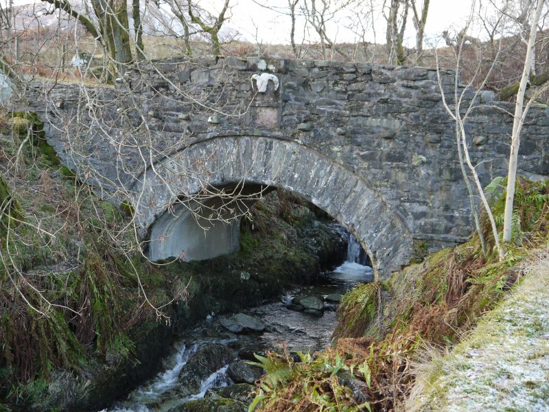
Dated 1777. Single span bridge carrying the road over stream. Low rubble parapet, now heavily slaister mortered with cement. Plaque on right parapet inscribed "SIC 1777".
Chapel Hill Bridge, also in Glen Luss, is listed separately.
External links are from the relevant listing authority and, where applicable, Wikidata. Wikidata IDs may be related buildings as well as this specific building. If you want to add or update a link, you will need to do so by editing the Wikidata entry.


Other nearby listed buildings
