Approximate Location Map
Large Map »
Latitude: 56.002 / 56°0'7"N
Longitude: -2.6245 / 2°37'28"W
OS Eastings: 361153
OS Northings: 678964
OS Grid: NT611789
Mapcode National: GBR 2Y.TY1S
Mapcode Global: WH8VY.NDGM
Plus Code: 9C8V292G+R6
Entry Name: Dam Bridge, Tyninghame
Listing Name: Tyninghame Dam Bridge
Listing Date: 17 May 1989
Category: C
Source: Historic Scotland
Source ID: 347966
Historic Scotland Designation Reference: LB14584
Building Class: Cultural
ID on this website: 200347966
Location: Whitekirk and Tyninghame
County: East Lothian
Electoral Ward: Dunbar and East Linton
Parish: Whitekirk And Tyninghame
Traditional County: East Lothian
Tagged with: Bridge
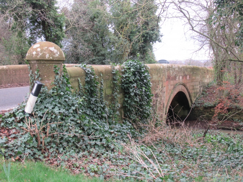
Circa 1840. Single arched bridge over River Tyne by
Tyninghame Sawmill. Stugged red rubble with rounded coping to
parapet and mushroom piers. Voussoired recessed surround
to arch with hoodmould. Path of the parapets nipped in above
arch.
Probably by George Sked, engineer, who built the sawmill
in 1828 with Thomas Hannan.
B Group with Items 16, 17, 28-37, 39.
External links are from the relevant listing authority and, where applicable, Wikidata. Wikidata IDs may be related buildings as well as this specific building. If you want to add or update a link, you will need to do so by editing the Wikidata entry.


Other nearby listed buildings
