Approximate Location Map
Large Map »
Latitude: 55.9434 / 55°56'36"N
Longitude: -2.3664 / 2°21'59"W
OS Eastings: 377212
OS Northings: 672322
OS Grid: NT772723
Mapcode National: GBR NFJ0.6M4
Mapcode Global: WH8W8.MWC2
Plus Code: 9C7VWJVM+9C
Entry Name: Old Bridge, Dunglass
Listing Name: Dunglass, Old Bridge
Listing Date: 5 February 1971
Category: B
Source: Historic Scotland
Source ID: 348156
Historic Scotland Designation Reference: LB14727
Building Class: Cultural
ID on this website: 200348156
Location: Oldhamstocks
County: East Lothian
Electoral Ward: East Berwickshire
Parish: Oldhamstocks
Traditional County: East Lothian
Tagged with: Bridge
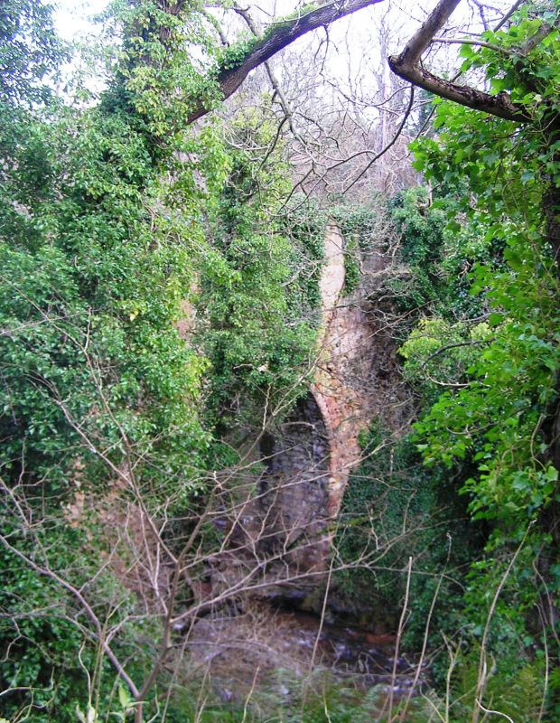
17th century, raised and improved in 19th century. Single
span, barrel arch bridge, spanning circa 34' over Dunglass
dene by the mill. Random rubble with ashlar voussoir, raised
in squared and coursed rubble. Strengthened with wrought-iron
ties. Also listed in Cockburnspath Parish, Scottish Borders.
The oldest in a series of 4 bridges in close proximity,
bridging between East Lothian and Berwickshire.
External links are from the relevant listing authority and, where applicable, Wikidata. Wikidata IDs may be related buildings as well as this specific building. If you want to add or update a link, you will need to do so by editing the Wikidata entry.


Other nearby listed buildings
