Approximate Location Map
Large Map »
Latitude: 55.9595 / 55°57'34"N
Longitude: -2.608 / 2°36'28"W
OS Eastings: 362136
OS Northings: 674219
OS Grid: NT621742
Mapcode National: GBR 2Z.XG0X
Mapcode Global: WH8W4.XG8Q
Plus Code: 9C7VX95R+QQ
Entry Name: Tron, East Green, Stenton
Listing Name: Stenton, East Green, Tron
Listing Date: 2 May 1990
Category: B
Source: Historic Scotland
Source ID: 348271
Historic Scotland Designation Reference: LB14803
Building Class: Cultural
ID on this website: 200348271
Location: Stenton
County: East Lothian
Electoral Ward: Dunbar and East Linton
Parish: Stenton
Traditional County: East Lothian
Tagged with: Architectural structure
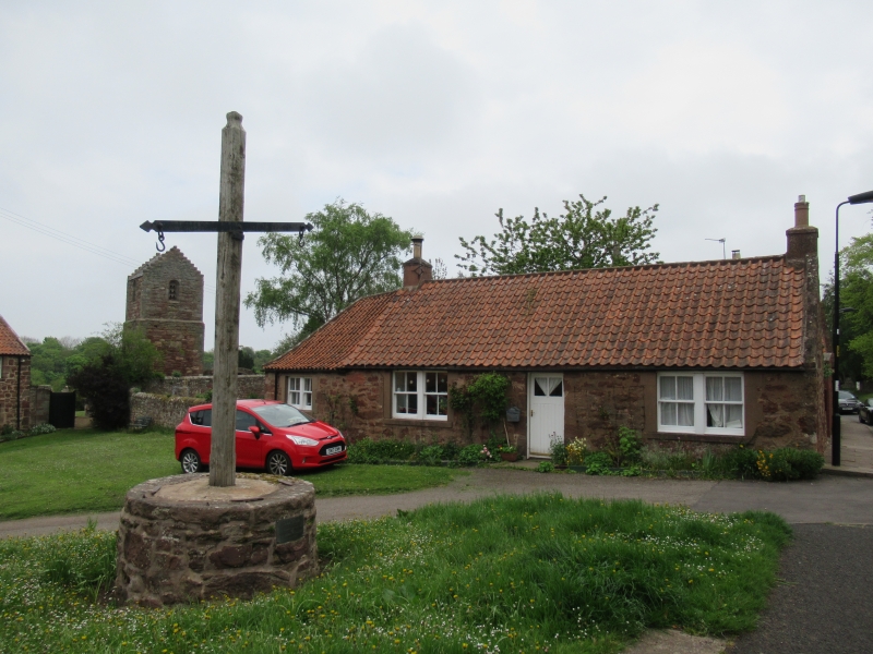
Early 19th century. Weighing cross or wool-stone.
Circular section rubble base, bearing slender timber post
and simple hooked scales.
Served for weighing wool at Stenton fairs.
External links are from the relevant listing authority and, where applicable, Wikidata. Wikidata IDs may be related buildings as well as this specific building. If you want to add or update a link, you will need to do so by editing the Wikidata entry.


Other nearby listed buildings
