Approximate Location Map
Large Map »
Latitude: 55.5062 / 55°30'22"N
Longitude: -3.4254 / 3°25'31"W
OS Eastings: 310067
OS Northings: 624530
OS Grid: NT100245
Mapcode National: GBR 44JR.6Z
Mapcode Global: WH6VM.CV2Q
Plus Code: 9C7RGH4F+FR
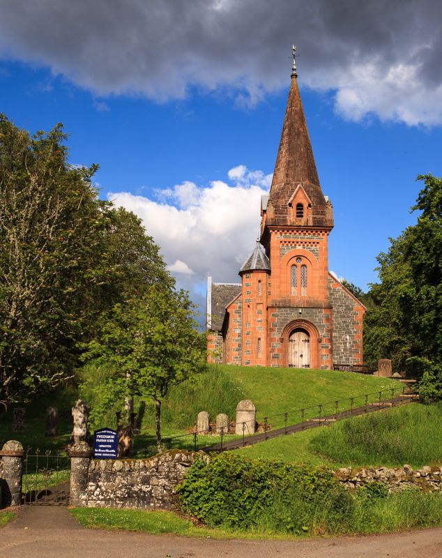
Entry Name: Tweedsmuir Parish Church
Listing Name: Tweedsmuir Parish Church and Churchyard
Listing Date: 23 February 1971
Category: B
Source: Historic Scotland
Source ID: 349018
Historic Scotland Designation Reference: LB15424
Building Class: Cultural
ID on this website: 200349018
Location: Tweedsmuir
County: Scottish Borders
Electoral Ward: Tweeddale West
Parish: Tweedsmuir
Traditional County: Peeblesshire
Tagged with: Church building
Present church erected 1874 on site of earlier structure built in 1643. It is an unusual Normal style design, flat T shape on plan, gabled, and with a squat tower and spire. The surrounding churchyard which occupies the summit of a mound contains some interesting 18th century tombstones.
Ecclesiastical building in use as such.
External links are from the relevant listing authority and, where applicable, Wikidata. Wikidata IDs may be related buildings as well as this specific building. If you want to add or update a link, you will need to do so by editing the Wikidata entry.


Other nearby listed buildings
