Approximate Location Map
Large Map »
Latitude: 57.0947 / 57°5'40"N
Longitude: -2.2629 / 2°15'46"W
OS Eastings: 384166
OS Northings: 800445
OS Grid: NJ841004
Mapcode National: GBR XG.94M3
Mapcode Global: WH9QV.6XNZ
Plus Code: 9C9V3PVP+VR
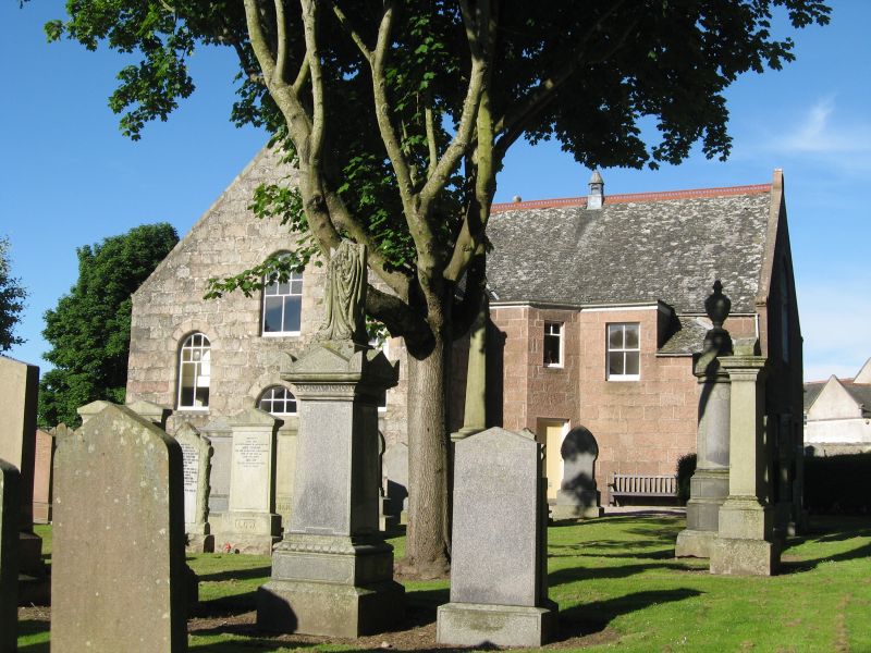
Entry Name: St Peter's Parish Church, Station Road South, Peterculter
Listing Name: St. Peter's Churchyard, Peterculter
Listing Date: 26 January 1981
Category: C
Source: Historic Scotland
Source ID: 349397
Historic Scotland Designation Reference: LB15712
Building Class: Cultural
Also known as: Peterculter Cemetery, Petereculter Churchyard, Peterculter Kirkyard
ID on this website: 200349397
Location: Peterculter
County: Aberdeen
Electoral Ward: Lower Deeside
Parish: Peterculter
Traditional County: Aberdeenshire
Tagged with: Cemetery
Rubble-walled enclosure with small watch house. Late 18th
century marble monument to Patrick Duff of Culter only
monument of special note.
External links are from the relevant listing authority and, where applicable, Wikidata. Wikidata IDs may be related buildings as well as this specific building. If you want to add or update a link, you will need to do so by editing the Wikidata entry.


Other nearby listed buildings
