Approximate Location Map
Large Map »
Latitude: 57.1206 / 57°7'14"N
Longitude: -2.1916 / 2°11'29"W
OS Eastings: 388498
OS Northings: 803312
OS Grid: NJ884033
Mapcode National: GBR XL.0912
Mapcode Global: WH9QW.99N3
Plus Code: 9C9V4RC5+69
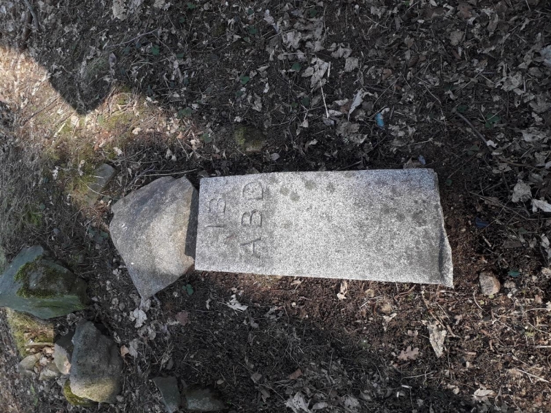
Entry Name: Boundary Marker 13, Mains Of Cults, Aberdeen
Listing Name: March Stone No. 13 in a Quarry N.w. of Mains of Cults.
Listing Date: 16 April 1971
Category: B
Source: Historic Scotland
Source ID: 349422
Historic Scotland Designation Reference: LB15737
Building Class: Cultural
ID on this website: 200349422
Location: Peterculter
County: Aberdeen
Electoral Ward: Lower Deeside
Parish: Peterculter
Traditional County: Aberdeenshire
Tagged with: Boundary marker
Marked ABD 13. Simple granite stone tapered at top on plinth.
External links are from the relevant listing authority and, where applicable, Wikidata. Wikidata IDs may be related buildings as well as this specific building. If you want to add or update a link, you will need to do so by editing the Wikidata entry.


Other nearby listed buildings
