Approximate Location Map
Large Map »
Latitude: 57.334 / 57°20'2"N
Longitude: -2.2079 / 2°12'28"W
OS Eastings: 387584
OS Northings: 827066
OS Grid: NJ875270
Mapcode National: GBR N9XB.F7N
Mapcode Global: WH9PQ.1XXL
Plus Code: 9C9V8QMR+HV
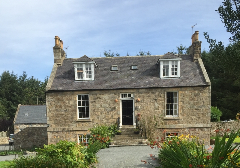
Entry Name: Atholhill
Listing Name: Atholhill Farmhouse
Listing Date: 11 September 1984
Category: C
Source: Historic Scotland
Source ID: 349628
Historic Scotland Designation Reference: LB15927
Building Class: Cultural
ID on this website: 200349628
Location: Udny
County: Aberdeenshire
Electoral Ward: Mid Formartine
Parish: Udny
Traditional County: Aberdeenshire
Tagged with: Farmhouse
Circa 1830/45. Single-storey basmeent and attic pinned
granite, 2-window and centre door, steps with curved splay
and cast railings; 2 piended 2-light dormers later.
Original woodwork.
External links are from the relevant listing authority and, where applicable, Wikidata. Wikidata IDs may be related buildings as well as this specific building. If you want to add or update a link, you will need to do so by editing the Wikidata entry.


Other nearby listed buildings
