Approximate Location Map
Large Map »
Latitude: 57.16 / 57°9'35"N
Longitude: -2.3426 / 2°20'33"W
OS Eastings: 379376
OS Northings: 807730
OS Grid: NJ793077
Mapcode National: GBR XB.CY03
Mapcode Global: WH8PG.Z9NF
Plus Code: 9C9V5M54+XX
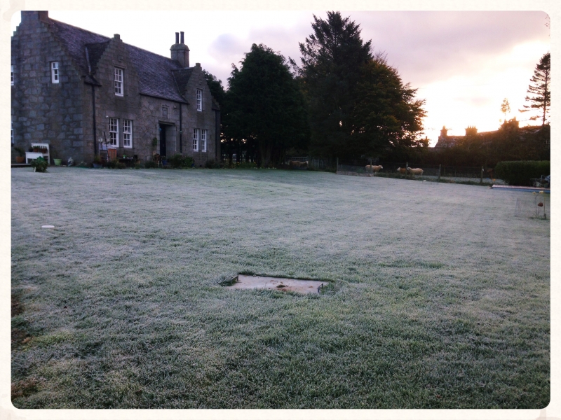
Entry Name: East Lochside
Listing Name: East Lochside Farmhouse
Listing Date: 11 September 1984
Category: B
Source: Historic Scotland
Source ID: 350261
Historic Scotland Designation Reference: LB16529
Building Class: Cultural
ID on this website: 200350261
Location: Skene
County: Aberdeenshire
Electoral Ward: Westhill and District
Parish: Skene
Traditional County: Aberdeenshire
Tagged with: Farmhouse
Dr. Wm. Kelly and David Morris. Dated 1931. Single-storey
and attic rubble-built and crowstepped, 2-gable front.
External links are from the relevant listing authority and, where applicable, Wikidata. Wikidata IDs may be related buildings as well as this specific building. If you want to add or update a link, you will need to do so by editing the Wikidata entry.


Other nearby listed buildings
