Approximate Location Map
Large Map »
Latitude: 56.1262 / 56°7'34"N
Longitude: -3.5938 / 3°35'37"W
OS Eastings: 301023
OS Northings: 693747
OS Grid: NT010937
Mapcode National: GBR 1S.L2KP
Mapcode Global: WH5QH.R8WY
Plus Code: 9C8R4CG4+FF
Entry Name: Shieldbank
Listing Name: Sandydub Shieldbank Farm
Listing Date: 20 June 1972
Category: B
Source: Historic Scotland
Source ID: 350851
Historic Scotland Designation Reference: LB17008
Building Class: Cultural
ID on this website: 200350851
Location: Saline
County: Fife
Electoral Ward: West Fife and Coastal Villages
Parish: Saline
Traditional County: Fife
Tagged with: Building
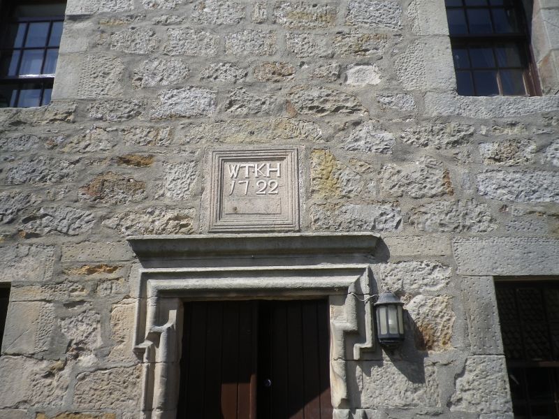
Two storey farmhouse now used as workshop and store. Rubble
and slate, crowstepped, moulded doorpiece with inset panel
over having raised letters, WT KH 1722.
External links are from the relevant listing authority and, where applicable, Wikidata. Wikidata IDs may be related buildings as well as this specific building. If you want to add or update a link, you will need to do so by editing the Wikidata entry.


Other nearby listed buildings
