Approximate Location Map
Large Map »
Latitude: 56.6576 / 56°39'27"N
Longitude: -2.8018 / 2°48'6"W
OS Eastings: 350943
OS Northings: 752044
OS Grid: NO509520
Mapcode National: GBR VP.KM5N
Mapcode Global: WH7QF.XXZL
Plus Code: 9C8VM55X+27
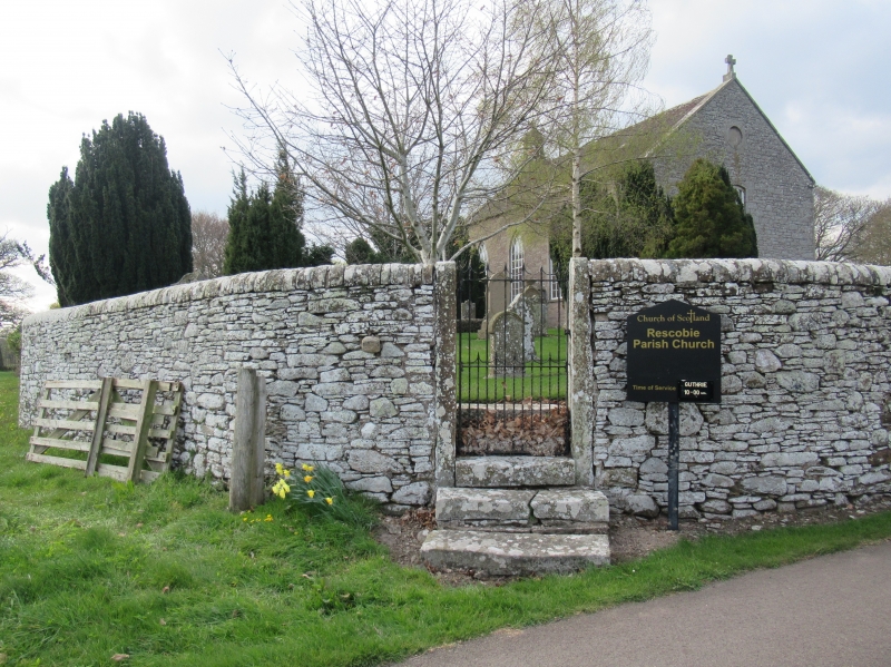
Entry Name: Rescobie Parish Kirk And Churchyard
Listing Name: Kirkyard Walls
Listing Date: 11 June 1971
Category: B
Source: Historic Scotland
Source ID: 351643
Historic Scotland Designation Reference: LB17679
Building Class: Cultural
ID on this website: 200351643
Location: Rescobie
County: Angus
Electoral Ward: Forfar and District
Parish: Rescobie
Traditional County: Angus
Tagged with: Church building Churchyard
Rubble enclosing walls and plain ashlar gate piers. Rebuilt
19th century. The yard contains good carved gravestones
and "St.Triduane's Stone".
External links are from the relevant listing authority and, where applicable, Wikidata. Wikidata IDs may be related buildings as well as this specific building. If you want to add or update a link, you will need to do so by editing the Wikidata entry.


Other nearby listed buildings
