Approximate Location Map
Large Map »
Latitude: 56.6565 / 56°39'23"N
Longitude: -2.8117 / 2°48'41"W
OS Eastings: 350337
OS Northings: 751930
OS Grid: NO503519
Mapcode National: GBR VN.YQWZ
Mapcode Global: WH7QF.SY9F
Plus Code: 9C8VM54Q+J8
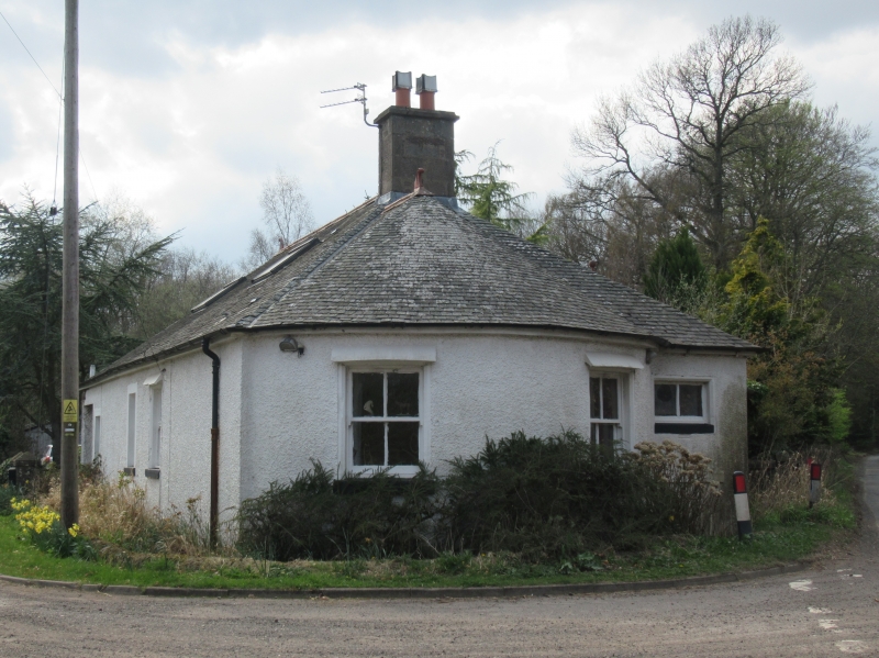
Entry Name: Tollhouse, Clocksbriggs
Listing Name: "The Old Toll House" Clocksbriggs
Listing Date: 15 January 1980
Category: C
Source: Historic Scotland
Source ID: 351647
Historic Scotland Designation Reference: LB17683
Building Class: Cultural
ID on this website: 200351647
Location: Rescobie
County: Angus
Electoral Ward: Forfar and District
Parish: Rescobie
Traditional County: Angus
Tagged with: Tollhouse
Small single-storey, harl and slate with bow front.
Originally toll-house c. 1840. Being reconditioned 1960.
External links are from the relevant listing authority and, where applicable, Wikidata. Wikidata IDs may be related buildings as well as this specific building. If you want to add or update a link, you will need to do so by editing the Wikidata entry.


Other nearby listed buildings
