Approximate Location Map
Large Map »
Latitude: 56.4684 / 56°28'6"N
Longitude: -5.7018 / 5°42'6"W
OS Eastings: 172079
OS Northings: 736836
OS Grid: NM720368
Mapcode National: GBR DC9M.933
Mapcode Global: WH0G2.DP24
Plus Code: 9C8PF79X+87
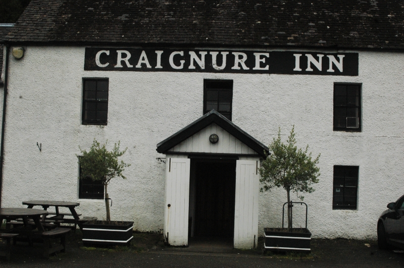
Entry Name: Craignure Inn, Craignure, Mull
Listing Name: Craignure Inn
Listing Date: 20 July 1971
Category: B
Source: Historic Scotland
Source ID: 351969
Historic Scotland Designation Reference: LB17973
Building Class: Cultural
Also known as: Mull, Craignure, Craignure Inn
ID on this website: 200351969
18th century. Traditional. 2-storey main block with 1 1/2 storey wings at ends. Harled. Gabled. Slated roof.
External links are from the relevant listing authority and, where applicable, Wikidata. Wikidata IDs may be related buildings as well as this specific building. If you want to add or update a link, you will need to do so by editing the Wikidata entry.


Other nearby listed buildings
