Approximate Location Map
Large Map »
Latitude: 56.5366 / 56°32'11"N
Longitude: -2.7437 / 2°44'37"W
OS Eastings: 354361
OS Northings: 738530
OS Grid: NO543385
Mapcode National: GBR VR.12QX
Mapcode Global: WH7R1.TYPW
Plus Code: 9C8VG7P4+JG
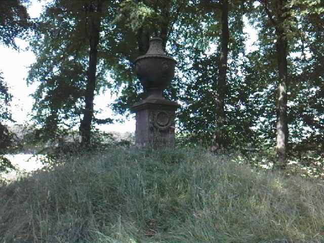
Entry Name: Margaret's Mount, Panmure Estate
Listing Name: Panmure Estate Margaret's Mount.
Listing Date: 11 June 1971
Category: B
Source: Historic Scotland
Source ID: 352462
Historic Scotland Designation Reference: LB18420
Building Class: Cultural
ID on this website: 200352462
Location: Panbride
County: Angus
Electoral Ward: Carnoustie and District
Parish: Panbride
Traditional County: Angus
Tagged with: Monument
Raised artificial mound with stone pedestal surmounted by
carved stone urn, 8ft. high. Early 18th cent. Commemorates
escape of Earl James after Sheriffmuir.
External links are from the relevant listing authority and, where applicable, Wikidata. Wikidata IDs may be related buildings as well as this specific building. If you want to add or update a link, you will need to do so by editing the Wikidata entry.


Other nearby listed buildings
