Approximate Location Map
Large Map »
Latitude: 58.9464 / 58°56'47"N
Longitude: -3.0987 / 3°5'55"W
OS Eastings: 336878
OS Northings: 1007097
OS Grid: HY368070
Mapcode National: GBR L5Q2.M7F
Mapcode Global: WH6B4.CDNF
Plus Code: 9CCRWWW2+HG
Entry Name: Kirbister Mill
Listing Name: Kirbister Meal Mill Kirbister.
Listing Date: 8 December 1971
Category: B
Source: Historic Scotland
Source ID: 352647
Historic Scotland Designation Reference: LB18576
Building Class: Cultural
ID on this website: 200352647
Location: Orphir
County: Orkney Islands
Electoral Ward: Kirkwall West and Orphir
Parish: Orphir
Traditional County: Orkney
Tagged with: Architectural structure
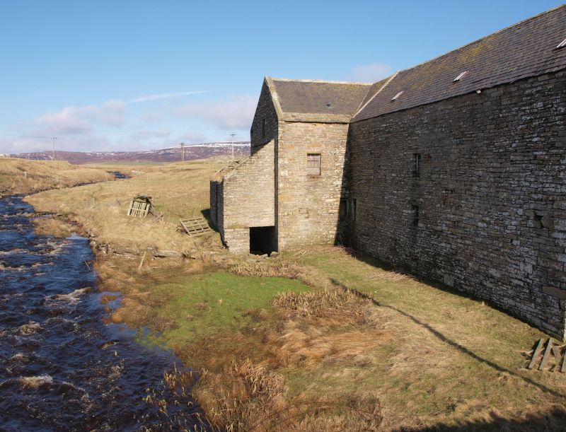
18th cent. 2 1/2 storeys. Random rubble. Slated roof.
Skews to gabled ends. Pent-house (formerly over wheel)
at W; Barn at E. Millstones and machinery lying outside.
Disused.
External links are from the relevant listing authority and, where applicable, Wikidata. Wikidata IDs may be related buildings as well as this specific building. If you want to add or update a link, you will need to do so by editing the Wikidata entry.


Other nearby listed buildings
