Approximate Location Map
Large Map »
Latitude: 58.9825 / 58°58'56"N
Longitude: -3.2517 / 3°15'6"W
OS Eastings: 328149
OS Northings: 1011267
OS Grid: HY281112
Mapcode National: GBR L4BZ.WNP
Mapcode Global: WH69W.0HV9
Plus Code: 9CCRXPJX+X8
Entry Name: Bridge Of Waithe
Listing Name: Bridge of Waithe
Listing Date: 9 December 1977
Category: C
Source: Historic Scotland
Source ID: 352685
Historic Scotland Designation Reference: LB18604
Building Class: Cultural
Also known as: Bridge of Waith
ID on this website: 200352685
Location: Stenness
County: Orkney Islands
Electoral Ward: West Mainland
Parish: Stenness
Tagged with: Road bridge Stone arch bridge
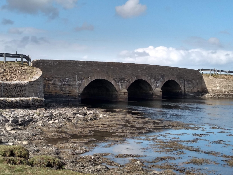
Dated 1859. 3 segmental arches. Coursed rubble. Flat
copings. Rounded cut-waters.
Replaced bridge of logs of wood borne on stone piers (OSA)
External links are from the relevant listing authority and, where applicable, Wikidata. Wikidata IDs may be related buildings as well as this specific building. If you want to add or update a link, you will need to do so by editing the Wikidata entry.


Other nearby listed buildings
