Approximate Location Map
Large Map »
Latitude: 58.8068 / 58°48'24"N
Longitude: -2.9796 / 2°58'46"W
OS Eastings: 343503
OS Northings: 991439
OS Grid: ND435914
Mapcode National: GBR M50G.1T0
Mapcode Global: WH7CX.6XD1
Plus Code: 9CCVR24C+P5
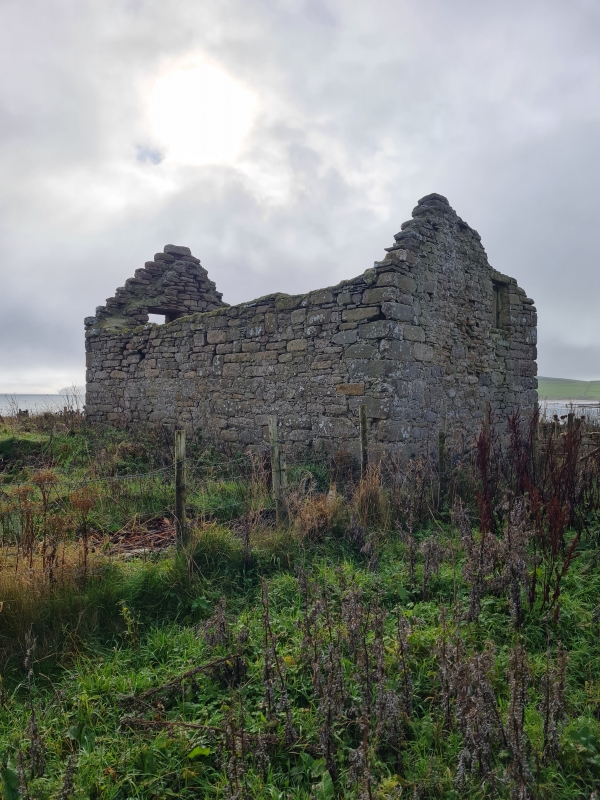
Entry Name: Kirkhouse Mill, South Ronaldsay
Listing Name: Kirkhouse Meal Mill Widewall
Listing Date: 8 December 1971
Category: B
Source: Historic Scotland
Source ID: 352846
Historic Scotland Designation Reference: LB18717
Building Class: Cultural
ID on this website: 200352846
Location: South Ronaldsay
County: Orkney Islands
Electoral Ward: East Mainland, South Ronaldsay and Burray
Parish: South Ronaldsay
Traditional County: Orkney
Tagged with: Architectural structure
Later 18th cent. 2 storeys. Rubble harl-pointed. Caithness
slates. Over-shot wheel housed under W. end. Lade. Kiln
at E. end: 3 storeys, slated roof with vent. Forestair.
Disused but retaining all machinery.
External links are from the relevant listing authority and, where applicable, Wikidata. Wikidata IDs may be related buildings as well as this specific building. If you want to add or update a link, you will need to do so by editing the Wikidata entry.


