Approximate Location Map
Large Map »
Latitude: 55.91 / 55°54'35"N
Longitude: -2.8959 / 2°53'45"W
OS Eastings: 344094
OS Northings: 668902
OS Grid: NT440689
Mapcode National: GBR 8063.V9
Mapcode Global: WH7V2.HQ76
Plus Code: 9C7VW453+XM
Entry Name: The Cross, Wester Pencaitland
Listing Name: Wester Pencaitland Mercat Cross
Listing Date: 13 May 1991
Category: B
Source: Historic Scotland
Source ID: 353160
Historic Scotland Designation Reference: LB18944
Building Class: Cultural
ID on this website: 200353160
Location: Pencaitland
County: East Lothian
Electoral Ward: Haddington and Lammermuir
Parish: Pencaitland
Traditional County: East Lothian
Tagged with: Market cross Architectural structure
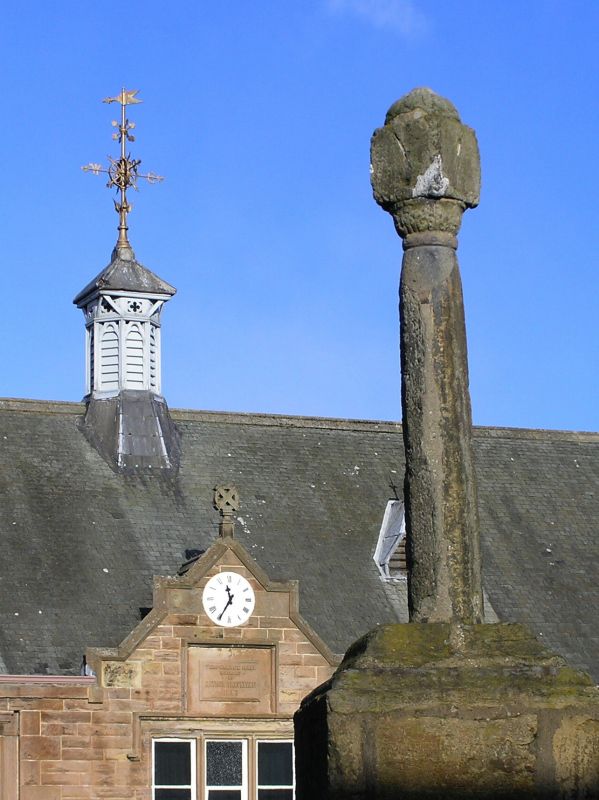
Probably late 17th century. Market cross sited by road
junction, comprised of tapering octagonal shaft bearing cubical sundial with copper gnomon; set on square pedestal of much-weathered ashlar and base of 5 shallow steps.
Steps formerly enclosed by railings.17th century date suggested because Pencaitland became a burgh of barony in 1695.
External links are from the relevant listing authority and, where applicable, Wikidata. Wikidata IDs may be related buildings as well as this specific building. If you want to add or update a link, you will need to do so by editing the Wikidata entry.


Other nearby listed buildings
