Approximate Location Map
Large Map »
Latitude: 55.6428 / 55°38'33"N
Longitude: -3.2261 / 3°13'33"W
OS Eastings: 322927
OS Northings: 639484
OS Grid: NT229394
Mapcode National: GBR 53X6.C1
Mapcode Global: WH6V4.FF0J
Plus Code: 9C7RJQVF+4H
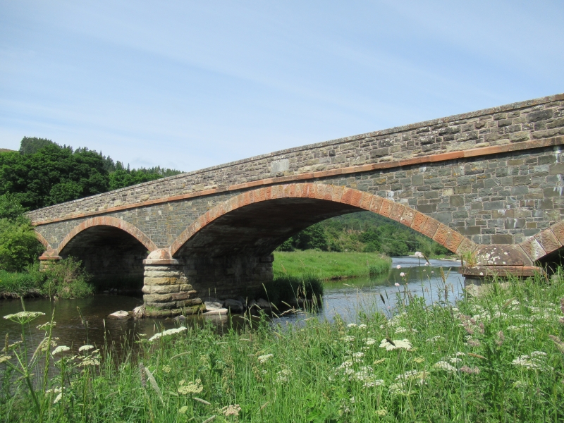
Entry Name: Manor Bridge
Listing Name: Manor Bridge over River Tweed
Listing Date: 1 March 1971
Category: B
Source: Historic Scotland
Source ID: 354154
Historic Scotland Designation Reference: LB19743
Building Class: Cultural
ID on this website: 200354154
Location: Manor
County: Scottish Borders
Electoral Ward: Tweeddale East
Parish: Manor
Traditional County: Peeblesshire
Tagged with: Bridge Road bridge
5 flat segmental arches, rounded outwaters; a wide graceful bridge opened in 1883 to replace the ford across River Tweed.
External links are from the relevant listing authority and, where applicable, Wikidata. Wikidata IDs may be related buildings as well as this specific building. If you want to add or update a link, you will need to do so by editing the Wikidata entry.


Other nearby listed buildings
