Approximate Location Map
Large Map »
Latitude: 56.2775 / 56°16'39"N
Longitude: -3.272 / 3°16'19"W
OS Eastings: 321334
OS Northings: 710175
OS Grid: NO213101
Mapcode National: GBR 25.8GVS
Mapcode Global: WH6R0.QG2Y
Plus Code: 9C8R7PHH+25
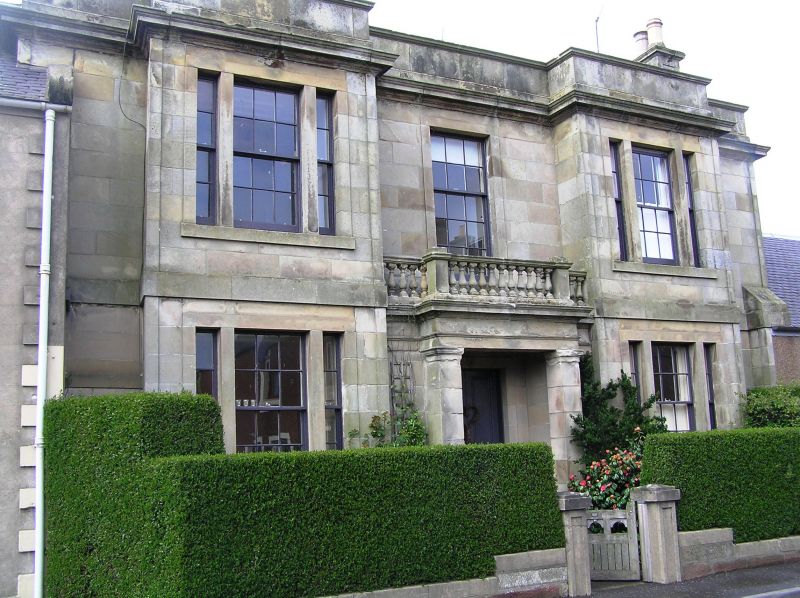
Entry Name: Clunie House, 89 High Street, Strathmiglo
Listing Name: Clunie House 89 High Street
Listing Date: 17 October 1973
Category: B
Source: Historic Scotland
Source ID: 354166
Historic Scotland Designation Reference: LB19755
Building Class: Cultural
ID on this website: 200354166
Location: Strathmiglo
County: Fife
Electoral Ward: Howe of Fife and Tay Coast
Parish: Strathmiglo
Traditional County: Fife
Tagged with: Building
Circa 1840. Greek revival. 2-storey 3-window ashlar front with twin tripartite bays and anta porch between with balustrade above. Top cornice and plain parapet, slated.
External links are from the relevant listing authority and, where applicable, Wikidata. Wikidata IDs may be related buildings as well as this specific building. If you want to add or update a link, you will need to do so by editing the Wikidata entry.


Other nearby listed buildings
