Approximate Location Map
Large Map »
Latitude: 57.1247 / 57°7'28"N
Longitude: -2.1683 / 2°10'5"W
OS Eastings: 389910
OS Northings: 803764
OS Grid: NJ899037
Mapcode National: GBR S1J.9G
Mapcode Global: WH9QW.N5PZ
Plus Code: 9C9V4RFJ+VM
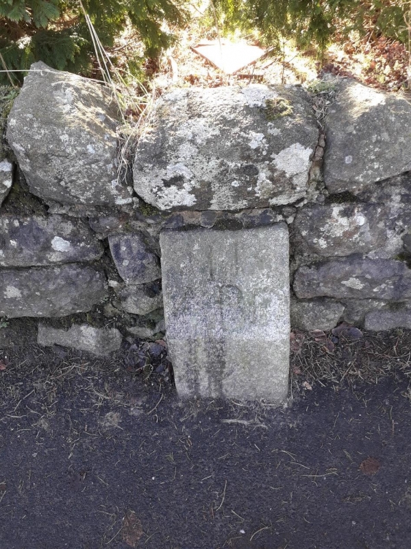
Entry Name: Boundary Marker 11, Craigton Road, Aberdeen
Listing Name: March Stone No. 11, on South Side of Craigton Road About 70 Yards West of the House 'East Rocklands'.
Listing Date: 12 January 1967
Category: B
Source: Historic Scotland
Source ID: 354466
Historic Scotland Designation Reference: LB20024
Building Class: Cultural
ID on this website: 200354466
Location: Aberdeen
County: Aberdeen
Town: Aberdeen
Electoral Ward: Lower Deeside
Traditional County: Aberdeenshire
Tagged with: Boundary marker
Marked 11 ABD.
External links are from the relevant listing authority and, where applicable, Wikidata. Wikidata IDs may be related buildings as well as this specific building. If you want to add or update a link, you will need to do so by editing the Wikidata entry.


Other nearby listed buildings
