Approximate Location Map
Large Map »
Latitude: 57.171 / 57°10'15"N
Longitude: -2.1686 / 2°10'6"W
OS Eastings: 389904
OS Northings: 808920
OS Grid: NJ899089
Mapcode National: GBR S1G.BB
Mapcode Global: WH9QP.N0KY
Plus Code: 9C9V5RCJ+CH
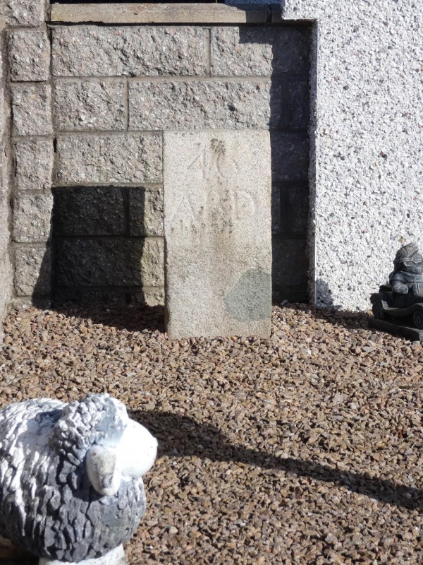
Entry Name: Boundary Marker 46, Westerton Of Auchmill, Aberdeen
Listing Name: March Stone No. 46 on the Farm of Westerton of Auchmill on the West Side of the Road About 50 Yards South-East of the Farm
Listing Date: 12 January 1967
Category: B
Source: Historic Scotland
Source ID: 354468
Historic Scotland Designation Reference: LB20026
Building Class: Cultural
ID on this website: 200354468
Location: Aberdeen
County: Aberdeen
Town: Aberdeen
Electoral Ward: Northfield/Mastrick North
Traditional County: Aberdeenshire
Tagged with: Boundary marker
Marked 46 ABD.
External links are from the relevant listing authority and, where applicable, Wikidata. Wikidata IDs may be related buildings as well as this specific building. If you want to add or update a link, you will need to do so by editing the Wikidata entry.


Other nearby listed buildings
