Approximate Location Map
Large Map »
Latitude: 57.1572 / 57°9'26"N
Longitude: -2.1054 / 2°6'19"W
OS Eastings: 393720
OS Northings: 807379
OS Grid: NJ937073
Mapcode National: GBR SBD.MX
Mapcode Global: WH9QQ.MCMJ
Plus Code: 9C9V5V4V+VR
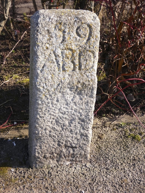
Entry Name: Boundary Marker 59, Elmbank Terrace, Aberdeen
Listing Name: March Stone No. 59, at Junction of Elmbank Terrace, Froghall Terrace and Canal Road.
Listing Date: 12 January 1967
Category: B
Source: Historic Scotland
Source ID: 354481
Historic Scotland Designation Reference: LB20039
Building Class: Cultural
ID on this website: 200354481
Location: Aberdeen
County: Aberdeen
Town: Aberdeen
Electoral Ward: George St/Harbour
Traditional County: Aberdeenshire
Tagged with: Boundary marker
Marked 59 ABD.
External links are from the relevant listing authority and, where applicable, Wikidata. Wikidata IDs may be related buildings as well as this specific building. If you want to add or update a link, you will need to do so by editing the Wikidata entry.


Other nearby listed buildings
