Approximate Location Map
Large Map »
Latitude: 56.5622 / 56°33'43"N
Longitude: -2.5839 / 2°35'2"W
OS Eastings: 364210
OS Northings: 741286
OS Grid: NO642412
Mapcode National: GBR VV.NHWC
Mapcode Global: WH8S8.8BT6
Plus Code: 9C8VHC68+VC
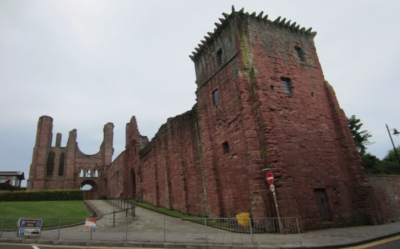
Entry Name: Arbroath Abbey - Regality Tower
Listing Date: 11 October 1971
Category: A
Source: Historic Scotland
Source ID: 356385
Historic Scotland Designation Reference: LB21133
Building Class: Cultural
ID on this website: 200356385
Location: Arbroath
County: Angus
Town: Arbroath
Electoral Ward: Arbroath East and Lunan
Traditional County: Angus
Tagged with: Architectural structure
Square keep, three-storey with vaulted floors and corbelled
parapet; formed N.W. corner of Abbey precincts adjoining the
regality courthouse. 13th century.
Under Guardianship of Ministry of Works.
External links are from the relevant listing authority and, where applicable, Wikidata. Wikidata IDs may be related buildings as well as this specific building. If you want to add or update a link, you will need to do so by editing the Wikidata entry.


Other nearby listed buildings
