Approximate Location Map
Large Map »
Latitude: 56.2917 / 56°17'30"N
Longitude: -3.2353 / 3°14'7"W
OS Eastings: 323636
OS Northings: 711715
OS Grid: NO236117
Mapcode National: GBR 26.7K4B
Mapcode Global: WH6R1.84M1
Plus Code: 9C8R7QR7+MV
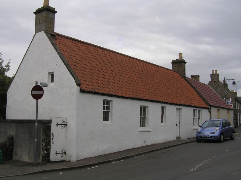
Entry Name: Ramleh, High Street, Auchtermuchty
Listing Name: Ramleh, High Street
Listing Date: 18 August 1972
Category: B
Source: Historic Scotland
Source ID: 356675
Historic Scotland Designation Reference: LB21399
Building Class: Cultural
ID on this website: 200356675
Location: Auchtermuchty
County: Fife
Town: Auchtermuchty
Electoral Ward: Howe of Fife and Tay Coast
Traditional County: Fife
Tagged with: Architectural structure
When the cottage was listed in 1972 it was described as having a thatched roof. Listed building record revised in 2021 as part of the Thatched Buildings Listing Review.
External links are from the relevant listing authority and, where applicable, Wikidata. Wikidata IDs may be related buildings as well as this specific building. If you want to add or update a link, you will need to do so by editing the Wikidata entry.


Other nearby listed buildings
