Approximate Location Map
Large Map »
Latitude: 56.2903 / 56°17'25"N
Longitude: -3.2402 / 3°14'24"W
OS Eastings: 323331
OS Northings: 711564
OS Grid: NO233115
Mapcode National: GBR 26.7Q0G
Mapcode Global: WH6R1.6593
Plus Code: 9C8R7QR5+4W
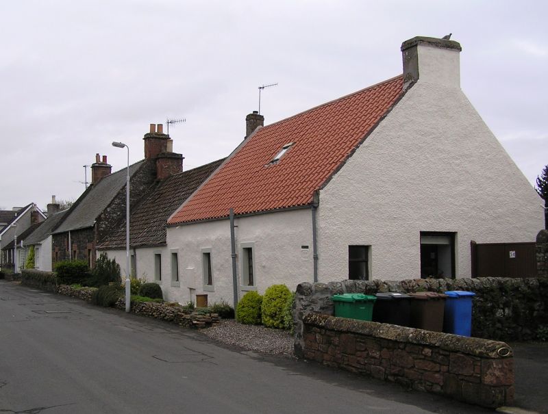
Entry Name: Ardloe, 54 High Road, Auchtermuchty
Listing Name: Ardloe, High Road
Listing Date: 23 November 1984
Category: C
Source: Historic Scotland
Source ID: 356685
Historic Scotland Designation Reference: LB21409
Building Class: Cultural
ID on this website: 200356685
Location: Auchtermuchty
County: Fife
Town: Auchtermuchty
Electoral Ward: Howe of Fife and Tay Coast
Traditional County: Fife
Tagged with: Architectural structure
Early 19th century. 2 single-storey cottages, 1 higher than
other, pink washed harl with margins pantiled; renovated.
External links are from the relevant listing authority and, where applicable, Wikidata. Wikidata IDs may be related buildings as well as this specific building. If you want to add or update a link, you will need to do so by editing the Wikidata entry.


Other nearby listed buildings
