Approximate Location Map
Large Map »
Latitude: 56.2922 / 56°17'31"N
Longitude: -3.2349 / 3°14'5"W
OS Eastings: 323663
OS Northings: 711765
OS Grid: NO236117
Mapcode National: GBR 26.7K7G
Mapcode Global: WH6R1.83TP
Plus Code: 9C8R7QR8+V2
Entry Name: Innervar, Parliament Place, Auchtermuchty
Listing Name: Madras Road, Parliament Place, Innervar
Listing Date: 18 August 1972
Category: B
Source: Historic Scotland
Source ID: 356736
Historic Scotland Designation Reference: LB21456
Building Class: Cultural
ID on this website: 200356736
Location: Auchtermuchty
County: Fife
Town: Auchtermuchty
Electoral Ward: Howe of Fife and Tay Coast
Traditional County: Fife
Tagged with: Architectural structure
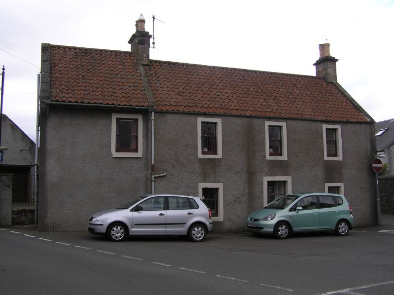
Dated 1768 at Lintel.
2-storey 3-window whin rubble and pantile, central door now
a window. Single-storey, 1-window harled wing, piended slated
roof.
External links are from the relevant listing authority and, where applicable, Wikidata. Wikidata IDs may be related buildings as well as this specific building. If you want to add or update a link, you will need to do so by editing the Wikidata entry.


Other nearby listed buildings
