Approximate Location Map
Large Map »
Latitude: 55.7998 / 55°47'59"N
Longitude: -4.4053 / 4°24'19"W
OS Eastings: 249320
OS Northings: 658899
OS Grid: NS493588
Mapcode National: GBR 3L.7MN0
Mapcode Global: WH3PD.9HG4
Plus Code: 9C7QQHXV+WV
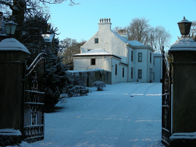
Entry Name: Chapell House, Aurthurlie, Barrhead
Listing Name: Chapell House, Gateside Road.
Listing Date: 10 June 1971
Category: B
Source: Historic Scotland
Source ID: 357585
Historic Scotland Designation Reference: LB22120
Building Class: Cultural
Also known as: Barrhead, Aurthurlie, Chapell House
Chapell House, Barrhead
ID on this website: 200357585
Location: Barrhead
County: East Renfrewshire
Town: Barrhead
Electoral Ward: Barrhead, Liboside and Uplawmoor
Traditional County: Renfrewshire
Tagged with: House
2-Storey & Attic main block with single-storey W. wing;
harled, with stone dressings; (probably c.1800 around
nucleus of c.1757?)
External links are from the relevant listing authority and, where applicable, Wikidata. Wikidata IDs may be related buildings as well as this specific building. If you want to add or update a link, you will need to do so by editing the Wikidata entry.


Other nearby listed buildings
