Approximate Location Map
Large Map »
Latitude: 56.2582 / 56°15'29"N
Longitude: -2.6274 / 2°37'38"W
OS Eastings: 361226
OS Northings: 707471
OS Grid: NO612074
Mapcode National: GBR 2Y.9PNC
Mapcode Global: WH8TL.MY1T
Plus Code: 9C8V795F+72
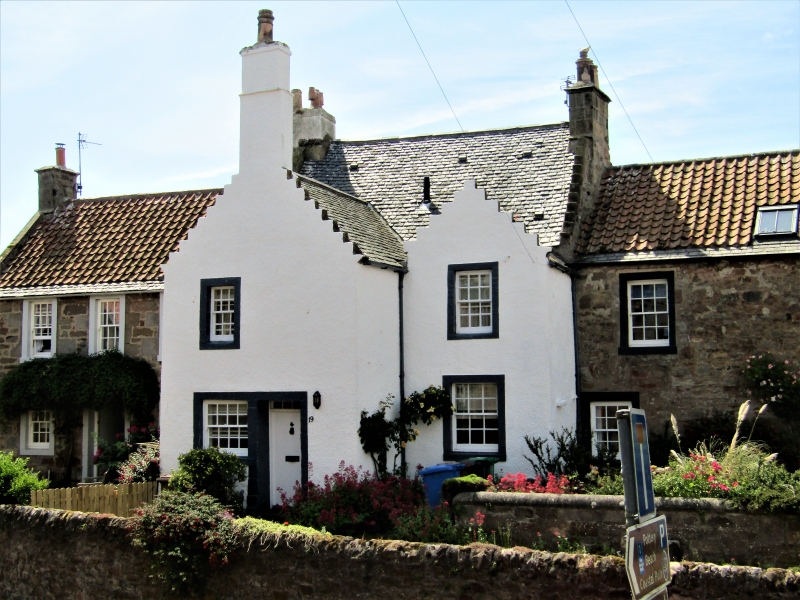
Entry Name: 19 Shoregate, Crail
Listing Name: 19 Shoregate
Listing Date: 9 May 1972
Category: B
Source: Historic Scotland
Source ID: 359110
Historic Scotland Designation Reference: LB23369
Building Class: Cultural
ID on this website: 200359110
Location: Crail
County: Fife
Town: Crail
Electoral Ward: East Neuk and Landward
Traditional County: Fife
Tagged with: Architectural structure
Originally 1613. 2-storey rectangle 2 gable-fronted wings of stepped projection, each 1-window added late 17th/early 18th century. Harled and whitewashed, slated 1970.
Within house former main door inscribed on lintel JOHN OTTIR: JANET ABEY: ANNO 1613.
External links are from the relevant listing authority and, where applicable, Wikidata. Wikidata IDs may be related buildings as well as this specific building. If you want to add or update a link, you will need to do so by editing the Wikidata entry.


Other nearby listed buildings
