Approximate Location Map
Large Map »
Latitude: 56.2586 / 56°15'30"N
Longitude: -2.6271 / 2°37'37"W
OS Eastings: 361245
OS Northings: 707516
OS Grid: NO612075
Mapcode National: GBR 2Y.9PQF
Mapcode Global: WH8TL.MY6H
Plus Code: 9C8V795F+C4
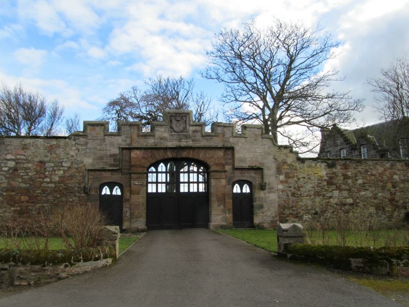
Entry Name: Castle Wall With Stabling And Coachhouses, Crail
Listing Name: Crail Castle Wall with Stabling and Coachhouses
Listing Date: 9 May 1972
Category: B
Source: Historic Scotland
Source ID: 359146
Historic Scotland Designation Reference: LB23400
Building Class: Cultural
ID on this website: 200359146
Location: Crail
County: Fife
Town: Crail
Electoral Ward: East Neuk and Landward
Traditional County: Fife
Tagged with: Architectural structure
Mid 19th century and earlier, coursed rubble: section at gateway snecked rubble; gates semi-elliptically arched, large centre gate flanked by footgates, coat of arms and sculptured heads, crenellated top; octagonal gazebo at S angle with crenellated parapet. Stabling and coachhouses,
single-storey and loft, crowstepped and slated with dormered loft door.
External links are from the relevant listing authority and, where applicable, Wikidata. Wikidata IDs may be related buildings as well as this specific building. If you want to add or update a link, you will need to do so by editing the Wikidata entry.


Other nearby listed buildings
