Approximate Location Map
Large Map »
Latitude: 56.3666 / 56°21'59"N
Longitude: -3.8522 / 3°51'7"W
OS Eastings: 285680
OS Northings: 720909
OS Grid: NN856209
Mapcode National: GBR 1G.2Y9F
Mapcode Global: WH4N2.S7TL
Plus Code: 9C8R948X+M4
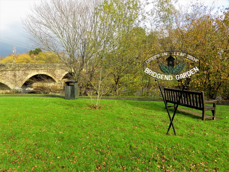
Entry Name: Crieff Bridge, Crieff
Listing Name: Crieff Bridge over River Earn
Listing Date: 5 October 1971
Category: B
Source: Historic Scotland
Source ID: 359289
Historic Scotland Designation Reference: LB23522
Building Class: Cultural
ID on this website: 200359289
Location: Crieff
County: Perth and Kinross
Town: Crieff
Electoral Ward: Strathearn
Traditional County: Perthshire
Tagged with: Bridge
1866-8. 4 segmental arches with cutwater buttresses. Squared, rock-faced rubble with voussoirs. Band course giving way to flat-coped rubble parapet.
The first Crieff Bridge, only the second thrown over the River Earn, was built during the 1690s with funds from "the vacant stipend of the parish, in the interval between the suppression of Episcopacy in 1690, and the re-admission of a Presbyterian minister in 1699" (Statistical Account).
External links are from the relevant listing authority and, where applicable, Wikidata. Wikidata IDs may be related buildings as well as this specific building. If you want to add or update a link, you will need to do so by editing the Wikidata entry.


Other nearby listed buildings
