Approximate Location Map
Large Map »
Latitude: 56.3176 / 56°19'3"N
Longitude: -3.0116 / 3°0'41"W
OS Eastings: 337527
OS Northings: 714365
OS Grid: NO375143
Mapcode National: GBR 2H.5TM0
Mapcode Global: WH7S2.QG4R
Plus Code: 9C8R8X9Q+29
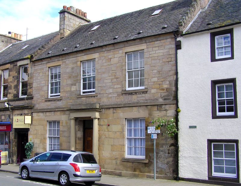
Entry Name: 78 Crossgate, Cupar
Listing Name: 78 Crossgate
Listing Date: 1 February 1972
Category: B
Source: Historic Scotland
Source ID: 360087
Historic Scotland Designation Reference: LB24210
Building Class: Cultural
ID on this website: 200360087
Location: Cupar
County: Fife
Town: Cupar
Electoral Ward: Cupar
Traditional County: Fife
Tagged with: Tenement
18th century, early 19th century 2-storey 3-window with
rusticated stucco ground floor with Roman-doric column
doorpiece, ashlar above; slated, crowstepped, one chimneyhead demolished.
External links are from the relevant listing authority and, where applicable, Wikidata. Wikidata IDs may be related buildings as well as this specific building. If you want to add or update a link, you will need to do so by editing the Wikidata entry.


Other nearby listed buildings
