Approximate Location Map
Large Map »
Latitude: 56.3193 / 56°19'9"N
Longitude: -3.0134 / 3°0'48"W
OS Eastings: 337416
OS Northings: 714559
OS Grid: NO374145
Mapcode National: GBR 2H.5T46
Mapcode Global: WH7S2.PF7F
Plus Code: 9C8R8X9P+PJ
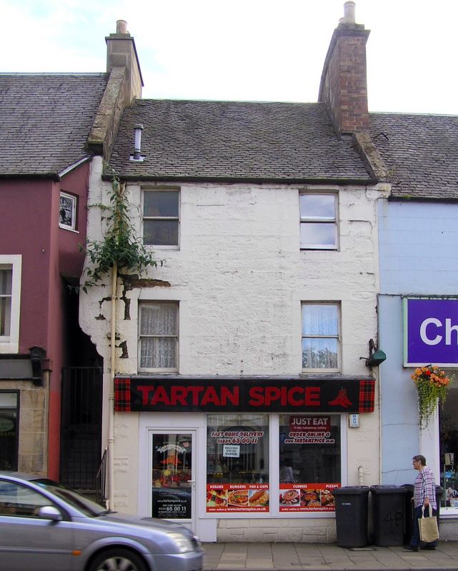
Entry Name: 42 Bonnygate, Cupar
Listing Name: 42 Bonnygate
Listing Date: 1 February 1972
Category: C
Source: Historic Scotland
Source ID: 360138
Historic Scotland Designation Reference: LB24254
Building Class: Cultural
ID on this website: 200360138
Location: Cupar
County: Fife
Town: Cupar
Electoral Ward: Cupar
Traditional County: Fife
Tagged with: Architectural structure
Rebuilt 19th century. 3-storey 2-window painted stone front;
margins; slated roof; ground floor shop; corner corbelled
over angle forestair of no 40.
Re-categorised as C(S) from B for Group (2006). The listing relates specifically to the group interest of the subject. It applies, as always, to interior as well as exterior, as appropriate to building type.
External links are from the relevant listing authority and, where applicable, Wikidata. Wikidata IDs may be related buildings as well as this specific building. If you want to add or update a link, you will need to do so by editing the Wikidata entry.


Other nearby listed buildings
