Approximate Location Map
Large Map »
Latitude: 56.3191 / 56°19'8"N
Longitude: -3.0145 / 3°0'52"W
OS Eastings: 337350
OS Northings: 714537
OS Grid: NO373145
Mapcode National: GBR 2H.5SV6
Mapcode Global: WH7S2.NFRK
Plus Code: 9C8R8X9P+J6
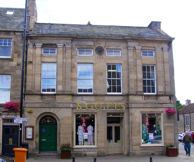
Entry Name: Freemasons Hall, 72-74 Bonnygate, Cupar
Listing Name: Freemasons' Hall, 72-74 Bonnygate
Listing Date: 1 February 1972
Category: B
Source: Historic Scotland
Source ID: 360147
Historic Scotland Designation Reference: LB24259
Building Class: Cultural
ID on this website: 200360147
Location: Cupar
County: Fife
Town: Cupar
Electoral Ward: Cupar
Traditional County: Fife
Tagged with: Hall
Dated 1811. 3-storey 4-window, end bays couple Roman-doric
pilastered, arched ground floor partly altered with square
heads later. Clockface centre 2nd floor. Ashlar, slated roof.
External links are from the relevant listing authority and, where applicable, Wikidata. Wikidata IDs may be related buildings as well as this specific building. If you want to add or update a link, you will need to do so by editing the Wikidata entry.


Other nearby listed buildings
