Approximate Location Map
Large Map »
Latitude: 54.9351 / 54°56'6"N
Longitude: -3.8199 / 3°49'11"W
OS Eastings: 283493
OS Northings: 561559
OS Grid: NX834615
Mapcode National: GBR 1CRC.SQ
Mapcode Global: WH5X6.9771
Plus Code: 9C6RW5PJ+22
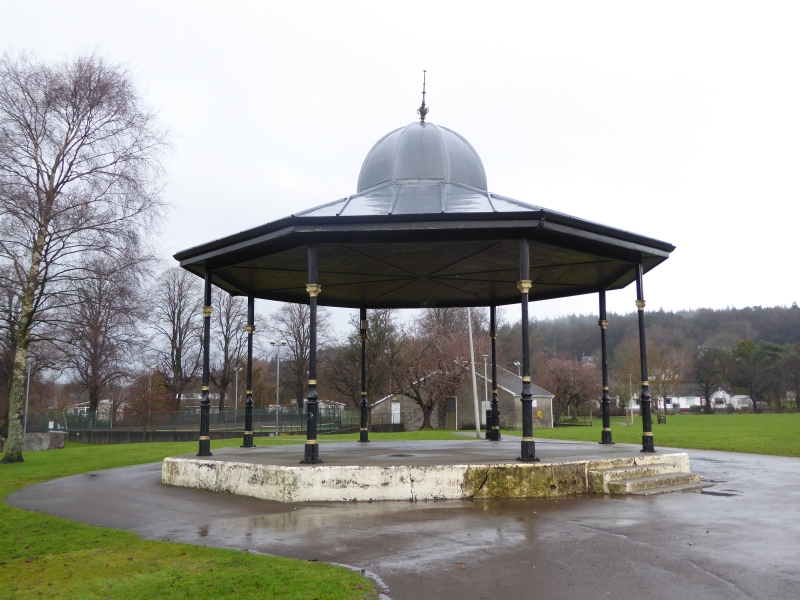
Entry Name: Bandstand, Colliston Park, Dalbeattie
Listing Name: Colliston Park Bandstand
Listing Date: 28 May 1981
Category: B
Source: Historic Scotland
Source ID: 360195
Historic Scotland Designation Reference: LB24305
Building Class: Cultural
ID on this website: 200360195
Location: Dalbeattie
County: Dumfries and Galloway
Town: Dalbeattie
Electoral Ward: Abbey
Traditional County: Kirkcudbrightshire
Tagged with: Bandstand
Circa 1900. Octagonal cast-iron pavilion bandstand manufactured at the Lion foundry. Slender cast-iron composite columns support depressed- arch, latticework screen; overhanging ocatgonal roof with central facetted hemispherical dome, spike finials at ridges and dome
apex. Octagonal concrete base.
Land for park gifted by Miss Copeland of Colliston in 1900.
External links are from the relevant listing authority and, where applicable, Wikidata. Wikidata IDs may be related buildings as well as this specific building. If you want to add or update a link, you will need to do so by editing the Wikidata entry.


Other nearby listed buildings
