Approximate Location Map
Large Map »
Latitude: 56.0032 / 56°0'11"N
Longitude: -2.5163 / 2°30'58"W
OS Eastings: 367897
OS Northings: 679033
OS Grid: NT678790
Mapcode National: GBR ND4V.HXK
Mapcode Global: WH8W0.9CZR
Plus Code: 9C8V2F3M+7F
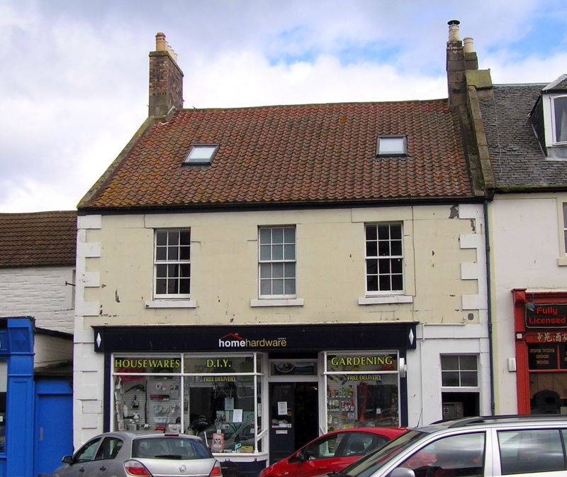
Entry Name: 133, 135 High Street, Dunbar
Listing Name: 133 and 135 High Street
Listing Date: 11 January 1988
Category: C
Source: Historic Scotland
Source ID: 360871
Historic Scotland Designation Reference: LB24794
Building Class: Cultural
ID on this website: 200360871
Location: Dunbar
County: East Lothian
Town: Dunbar
Electoral Ward: Dunbar and East Linton
Traditional County: East Lothian
Tagged with: Architectural structure
18th century. 2-storey, 3-bay house; shop at ground. Painted
ashlar with raised cills and quoins; rubble side elevation.
Plate glass sash windows. Plain skews and deep pantiled roof;
end stacks.
External links are from the relevant listing authority and, where applicable, Wikidata. Wikidata IDs may be related buildings as well as this specific building. If you want to add or update a link, you will need to do so by editing the Wikidata entry.


Other nearby listed buildings
