Approximate Location Map
Large Map »
Latitude: 55.0682 / 55°4'5"N
Longitude: -3.6094 / 3°36'33"W
OS Eastings: 297325
OS Northings: 576045
OS Grid: NX973760
Mapcode National: GBR 397T.CZ
Mapcode Global: WH5WJ.JWG0
Plus Code: 9C7R399R+77
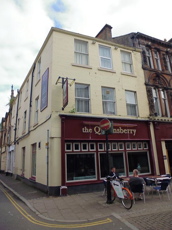
Entry Name: 18 English Street, Dumfries
Listing Name: 18 English Street, 2-6 Queen Street (Even Numbers)
Listing Date: 6 March 1981
Category: C
Source: Historic Scotland
Source ID: 362701
Historic Scotland Designation Reference: LB26179
Building Class: Cultural
ID on this website: 200362701
Location: Dumfries
County: Dumfries and Galloway
Town: Dumfries
Electoral Ward: Nith
Traditional County: Dumfriesshire
Tagged with: Architectural structure
Early 19th century. 3 storeys, modern shops at ground.
3 bays to English Street, 4 bays to Queen Street.
Painted droved ashlar. Plate-glass sashes. Axial stacks;
slate roof.
External links are from the relevant listing authority and, where applicable, Wikidata. Wikidata IDs may be related buildings as well as this specific building. If you want to add or update a link, you will need to do so by editing the Wikidata entry.


Other nearby listed buildings
