Approximate Location Map
Large Map »
Latitude: 55.0697 / 55°4'10"N
Longitude: -3.6124 / 3°36'44"W
OS Eastings: 297137
OS Northings: 576215
OS Grid: NX971762
Mapcode National: GBR 396T.QG
Mapcode Global: WH5WJ.HT1V
Plus Code: 9C7R399Q+V3
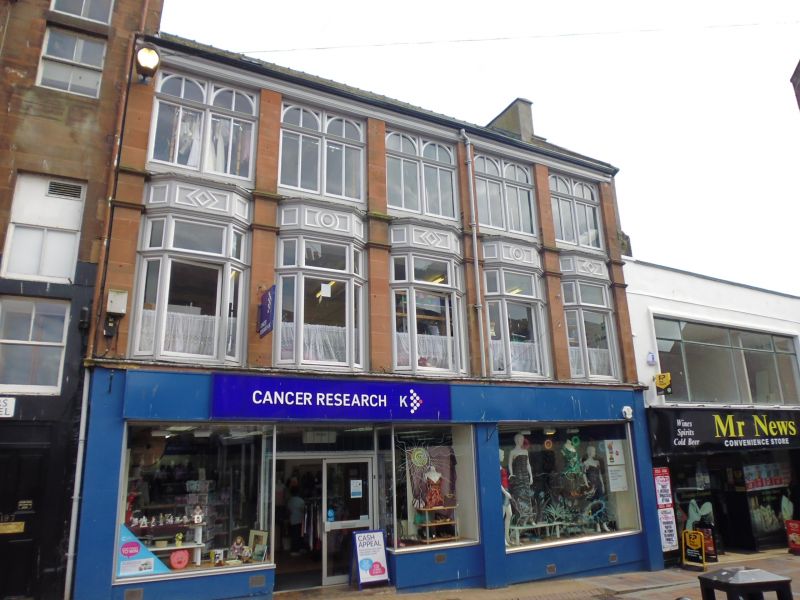
Entry Name: 114-116 Friars Vennel, Dumfries
Listing Name: 114, 116 Friars Vennel
Listing Date: 6 March 1981
Category: B
Source: Historic Scotland
Source ID: 362723
Historic Scotland Designation Reference: LB26196
Building Class: Cultural
ID on this website: 200362723
Location: Dumfries
County: Dumfries and Galloway
Town: Dumfries
Electoral Ward: Nith
Traditional County: Dumfriesshire
Tagged with: Architectural structure
Late 19th century. 3-storey framed building with red
sandstone faced pilasters, bays constructed with timber
and glass. 5 bays, transomed canted oriels at 1st floor
with panelled friezes; twin-arched mullioned and transomed
2nd floor windows; Modern ground floor shop. Straight
skews; end stacks; 3 skylights; slate roof.
B Group with 197 High Street. (Item 155)
External links are from the relevant listing authority and, where applicable, Wikidata. Wikidata IDs may be related buildings as well as this specific building. If you want to add or update a link, you will need to do so by editing the Wikidata entry.


Other nearby listed buildings
