Approximate Location Map
Large Map »
Latitude: 55.9029 / 55°54'10"N
Longitude: -3.164 / 3°9'50"W
OS Eastings: 327322
OS Northings: 668363
OS Grid: NT273683
Mapcode National: GBR 60B5.TT
Mapcode Global: WH6ST.CWLN
Plus Code: 9C7RWR3P+5C
Entry Name: Balm Well, St Catherine's House, Howdenhall Road, Edinburgh
Listing Name: St Catherine's Balm Well Howdenhall Road
Listing Date: 14 December 1970
Category: B
Source: Historic Scotland
Source ID: 365565
Historic Scotland Designation Reference: LB28122
Building Class: Cultural
ID on this website: 200365565
Location: Edinburgh
County: Edinburgh
Town: Edinburgh
Electoral Ward: Liberton/Gilmerton
Traditional County: Midlothian
Tagged with: Architectural structure
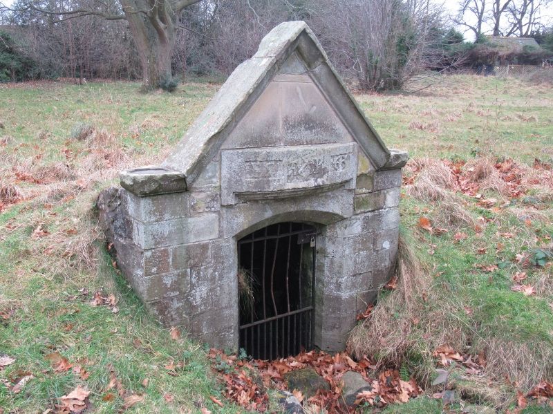
Original well house built 1617 by order of James VI. Small
vaulted structure with gables, ashlar Renaissance front.
Lintel of 1563.
Noticed by Hector Boece in 1526. Said to have originated in a
spilling of the oil of St Catherine brought to St Margaret
from Sinai
External links are from the relevant listing authority and, where applicable, Wikidata. Wikidata IDs may be related buildings as well as this specific building. If you want to add or update a link, you will need to do so by editing the Wikidata entry.


Other nearby listed buildings
